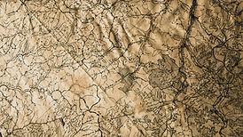

UAV technology allows for capturing vast amounts of data in a fast efficient manner and can access areas previously considered as hazardous or inaccessible
Aerial Mapping
Using the latest in drone technology we are able to undertake highly accurate surveys using Real Time Kinematic (RTK) and Post processed Kinematic (PPK) methods to provide a host of precise mapping data sets.
-
3D Point Clouds
-
High Resolution Geo-Referenced Orthometric Images
-
3D Textured Models for Viewing
-
Topographic data and volumetric surveys

The survey industry has always been at the forefront of new technology, embracing innovative methodolgy to aid in the gathering of accurate mapping data.
Using the latest in unmanned Aerial Platforms, Precision Air Surveys provide a fast, safe and efficient solution to all of your mapping requirements.

The Built Environment

Construction

Topographic & Agriculture

Coastal
Topographical Mapping - Condition Surveys - Property inspections - Construction Site Visualisation - High Resolution Images - 4K Video -
3D Point Clouds - DTM & Contour Models - 3d Textured Models - Golf Course Fly-by's